Pic on Site, Polycam or OpenSpace: which to choose for construction
There is no universal winner: the three platforms work with visual information, but they deliver different things. This guide compares findable photos, 3D scanning and 360 tours with official sources, real screens and explicit limits so you can choose based on the job you need to solve.
By Enrique Pérez González·
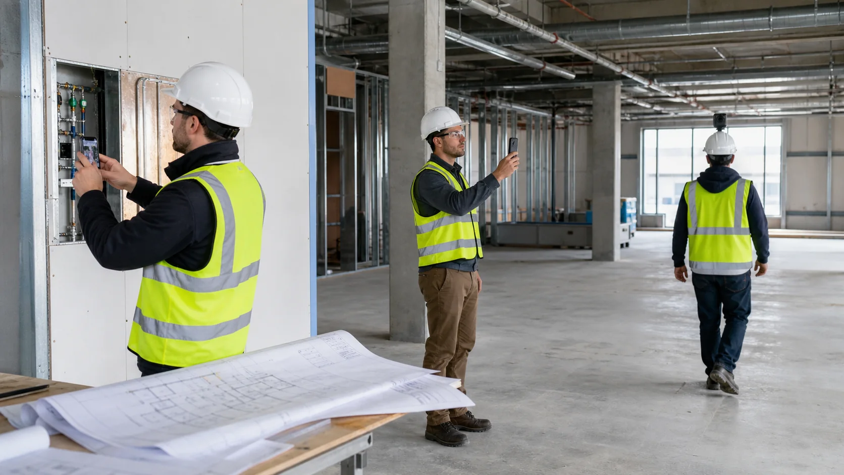
Three different modalities: document an observation, capture geometry and record the entire journey of a work.
Quick answer: what to choose
Choose Pic on Site if you need to organize and retrieve standard construction photos. Choose Polycam if you need 3D geometry, plans, or measurements from a capture. Choose OpenSpace if you need repeatable coverage of large areas, especially in 360, and want to compare the construction site over time. The tools can coexist when you need more than one of these outputs.
Pic on Site
Locatable photographs about the project
It fits when the team already takes photos with the mobile phone and needs to centralize them, place them on a map or plan when they retain valid GPS, and retrieve them by date, author, area or visual content.
Polycam
Geometry, measurement and 3D deliverables
Fits when the desired output is a model, mesh, point cloud, plane, or measurement obtained using LiDAR, photogrammetry, or other capture modes.
OpenSpace
Systematic coverage and 360 tours
It fits when an organization needs to frequently record large areas, tour them virtually, compare dates and relate the captured reality with plans, BIM and progress tracking.
The right question is not "which has more functions"
The question is what artifact should remain after the visit. A photo with context, a geometric model and a 360° tour solve different problems. Comparing them as if they were three variants of the same product leads to oversized purchases or expectations that the chosen tool cannot meet.
documentary photoAnswer what was seen, where it was and when it was recorded.
Geometric captureAnswer what shape and approximate dimensions the captured space or object had.
Reality tourIt answers how an entire area was during a visit and allows you to go through it again.
Overall comparison
Criterion
Pic on Site
Polycam
OpenSpace
Main focus
Contextualized photographic repository
3D capture and production
Reality capture of work and visual coordination
Typical catch
Normal photos with mobile
LiDAR, photogrammetry, 360 photo and other modes
360 tours; also mobile, drones and scanner data
Main result
Photos on map or plan, gallery and timeline
Meshes, models, splats, planes, measurements and point clouds according to mode and plan
Navigable visual tour, temporal comparison and data linked to plans/BIM
Specialized hardware
Not for basic flow
Not for a mesh with Space Mode; LiDAR is necessary for Floorplan and measured plans
The 360 tour requires a compatible camera; there are additional modalities
Geometric measurement
It is not its purpose
Yes, with tools and limits according to capture and plan
Available in specific Capture/BIM+ flows, not equivalent to a certified survey
Continuous coverage
It depends on what photographs the team takes
Depends on scanning path and coverage
Designed to record long, repeatable runs
Temporal comparison
Timeline and photo consultation by date
Possible comparison between captures, but it is not the core of a work diary
Split View, Reveal Mode and trace modules
BIM
Photographic support for review and As-Built
Exports for CAD/BIM flows according to format
Comparison between captured and model conditions; BIM+ expands the tools
Organizational scale
Teams that need to organize photos without changing how they capture them
Professionals and teams who need 3D assets
Contractors, owners and organizations with recurring capture programs
Visible purchasing model
Test and plans announced on the web; confirm availability
Free, Basic, Business and Enterprise public plans
Quote based on construction volume and subscription level
Analysis by platform
1 · Pic on Site
Its advantage is to keep the photograph as a photograph
Pic on Site starts from a simple reality: many projects already produce thousands of photos with standard mobile phones. The problem is not generating a 3D representation, but preventing those images from being scattered across galleries, chats, and folders with no clear link to the project.
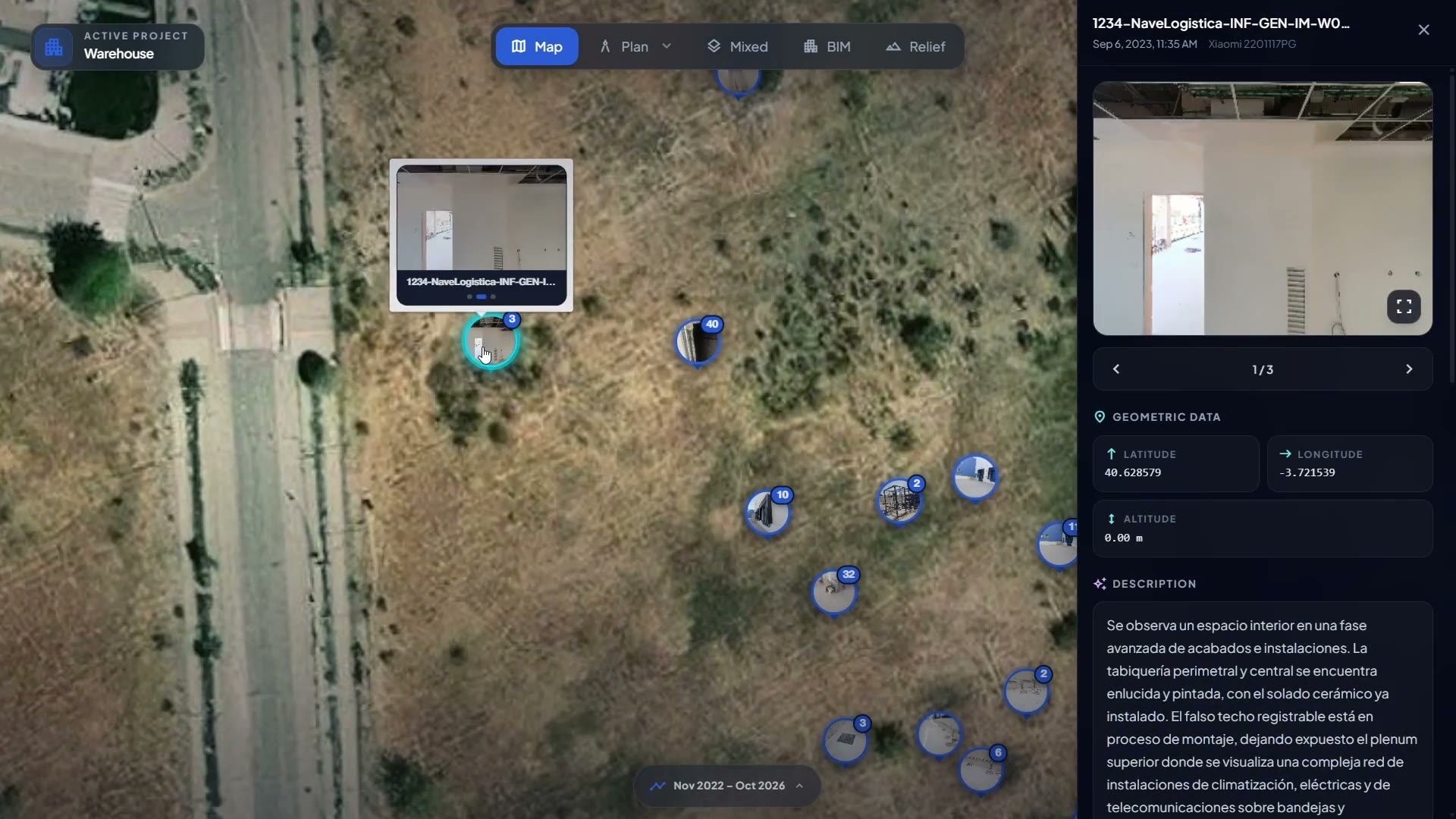
When the file retains valid GPS, the platform can locate it on georeferenced maps or plans. It also organizes by date and author, incorporates a timeline, automatic tagging and search by visual content. This reduces the need to remember the name of a file or the exact day it was taken.
Actual screenshot of Pic on Site. The product tour shows photographs grouped on the map, access to detail and location metadata. Source: Pic on Site public demo.
Where it stands out
Low capture barrier with already common photos.
Timely evidence of details, items and facilities.
Later recovery by context and content.
Flows where it is not worth capturing the entire work in 360 or 3D.
Where it does not replace the others
It does not generate a mesh or a point cloud of a conventional photo.
It does not offer geometric measurement from a 3D model.
It does not guarantee continuous coverage: only what someone photographed exists.
It does not automatically convert photos into validated contractual advance.
Its advantage is to turn capture into a space asset
Polycam offers five modes that should be separated: Space, Object, Floorplan, AI Capture and 360. Space Mode produces a 3D model of space; Object Mode uses photogrammetry or Gaussian Splats; Floorplan Mode generates plans and measurements; AI Capture creates a model from an image; and 360 Mode produces a panorama, not geometry. The result depends on the mode, device and subscription.
According to the current documentation, Space Mode works on compatible iOS devices with and without LiDAR. With LiDAR it can generate a mesh, floor model, and measured 2D floor plan; without LiDAR it generates a mesh, but not the measured 2D and 3D floor plans. Polycam also offers mesh, plan, and point-cloud exports, with availability depending on the subscription.
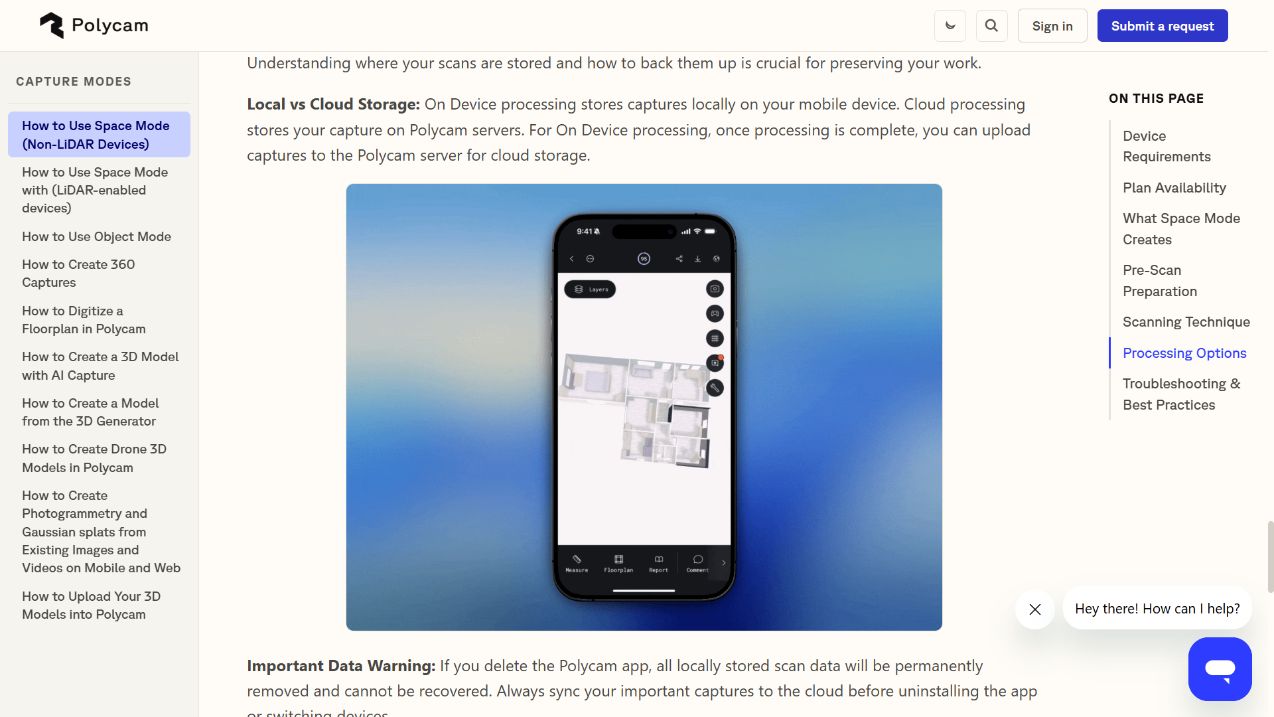
Polycam interface in its official help. The screenshot corresponds to the Space Mode guide without LiDAR and shows the spatial result within the application. See the official source.
Where it stands out
Quick surveys of rooms, objects and specific areas.
Production of meshes, splats, planes and point clouds.
Measurement and export to design tools.
Flexibility between individual, team and company use.
Limits to be checked
Results vary with lighting, path, occlusions and device.
Current Space modes and LiDAR shots have specific iOS requirements.
Advanced exports and saved measurements depend on the plan.
A mobile scan should not be assumed to be a certified survey.
Its advantage is repeatable construction-site coverage at scale
OpenSpace Capture is designed around a large, navigable visual record. The most characteristic flow consists of connecting a compatible 360 camera, walking through the work and letting the system associate the images with the plans. The platform also supports smartphone captures and expands its reach with data from drones and scanners.
Functions such as Split View, Reveal Mode, coverage confirmation, shared folders and Field Notes are built on top of that record. The official documentation also describes BIM Compare, coordination tools and integrations with Procore, Autodesk and Revizto. Structured progress tracking is part of the Progress Tracking offering and must be evaluated within the corresponding subscription.
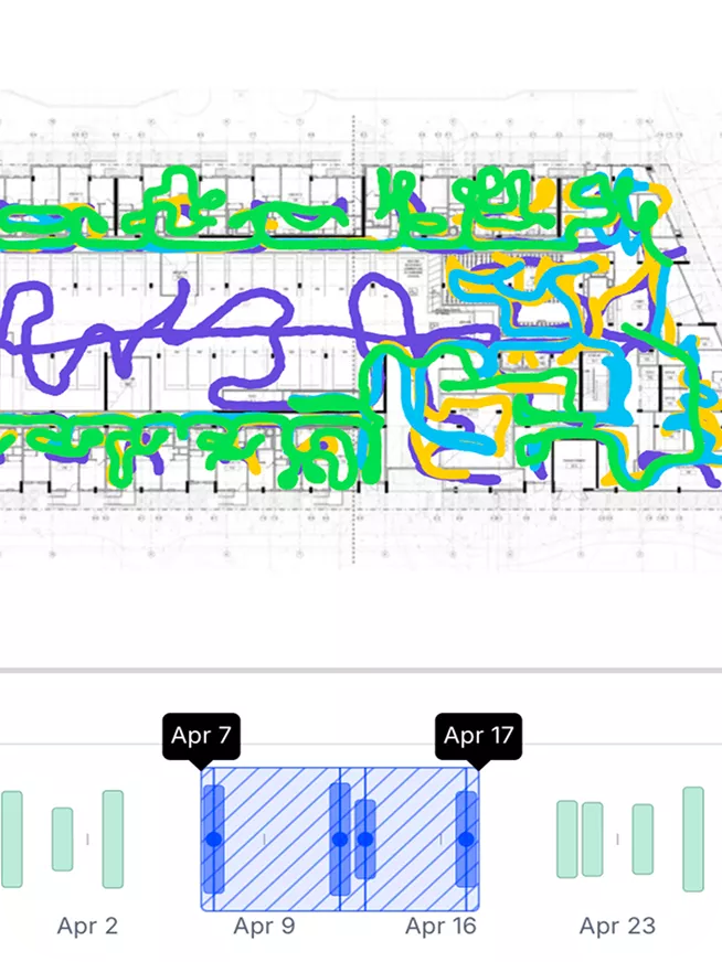
Screenshot posted by OpenSpace. The interface displays route maps and a time window to review coverage and progress between dates. See the official source.
Where it stands out
Recurrent registration of large surfaces.
Remote tour and visual comparison between dates.
Coordination between work, office, plans and BIM.
Implementation in multiple projects and business teams.
Limits to be checked
The 360 flow involves compatible camera, capture path and periodic discipline.
BIM+ and Progress Tracking extend the product and should be evaluated within the subscription.
A 360 view is not always a substitute for the detail of a targeted photo or an accurate scan.
Contracting is done through a quote, not as an individual fixed-price app.
A convincing image does not automatically turn a data point into a certified measurement or a work item into an accepted one. Accuracy and contractual value depend on the capture method, calibration, procedure, site conditions, and contract requirements.
Pic on Site: preserves and organizes visual evidence. Automatic location depends on the file including valid GPS and the map being correctly georeferenced. A photo can demonstrate appearance or condition, but by itself it does not certify dimensions or contractual acceptance.
Polycam: offers measurements derived from captures. Its own guidance links quality to stable lighting, line of sight, movement, and coverage; omitted areas may be estimated and reduce reliability. For critical tolerances, compare the result with the required instrument and procedure.
OpenSpace: provides a visual record and comparison or measurement tools in specific flows. Autolocation and BIM comparison facilitate review, but do not convert every observation into automatic geometric or contractual verification.
Free trial and plans shown on the web; confirm availability and current conditions.
Uploading and reviewing photos, preparation of plans and team filing discipline.
Polycam
Free; Basic for 150 USD/year (or 30 USD/month); Business for $400/year per user; Enterprise through commercial contact.
Compatible device, scan time, reprocessing, exports and receiving software.
OpenSpace
Quote according to the amount of construction; The website indicates unlimited captures and team members.
360 cameras, recurring routes, upload, onboarding, modules and organizational integration.
Prices consulted on August 14, 2026. Amounts change and may vary by country, taxes, billing and contract. Always consult the official pages of Polycam prices and OpenSpace quote.
Which tool fits the actual job
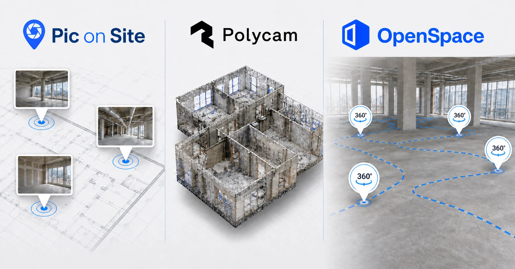
Generated conceptual illustration. Summarizes the three capture modalities to facilitate the decision; It is not a product screenshot nor does it represent the interface of any platform.
Choose Pic on Site if…
You need standard construction photos to stop being scattered, want to find them by area or content, and do not need to turn every visit into a 3D model or 360 walkthrough.
Choose Polycam if…
The deliverable is a mesh, point cloud, plan, measurement or model of a space or object and you can control the capture path and the device used.
Choose OpenSpace if…
you need to virtually tour large areas of work, repeat captures systematically, coordinate with BIM or implement visual monitoring in various projects and teams.
Don't choose yet if...
you haven't defined what needs to be recovered six months later, what coverage is mandatory, what measurement tolerance you need, who will capture and who will review. Without that flow, the software comparison will be superficial.
They can coexist
The choice is not always exclusive. The same work may require a daily photographic record, specific scans and 360 tours of specific milestones.
Pic on Site + PolycamTargeted photos for daily evidence and spot scans when geometry matters.
Pic on Site + OpenSpaceDetail or issue photos alongside periodic 360 walkthroughs for general coverage.
Polycam + OpenSpaceLocalized 3D captures for design or measurement along with a systematic temporal record of the work.
The combination only pays off if you define the reference source for each data type and how the results are linked. Duplicating captures without an archiving rule increases work and does not necessarily improve traceability. If the goal is to review progress and issues, this practical guide to comparing construction photos helps define the protocol before choosing software.
Checklist before buying
1. Define the result. Retrievable photo, 3D model, plan, measurement, 360 tour or quantified progress.
2. Try a real area. Includes low light, occlusions, installations and connectivity similar to the work.
4. Check the recovery. Ask another person to find the data without knowing how it was captured.
5. Validates accuracy and contract. Do not accept a generic figure if tolerance or probative value is critical.
6. Check the output. Formats, originals, metadata, API, portability and access upon termination of subscription.
7. Calculate hardware and operation. Phones, LiDAR, 360 cameras, storage, training and travel frequency.
8. Check security and permissions. Roles, guests, retention, residency, SSO and customer requirements.
Conclusion
The best choice is the one that produces the deliverable your team will actually use. Polycam fits when you need 3D geometry or measurements from a capture.OpenSpace fits systematic construction walkthroughs, date comparisons, BIM, and enterprise processes.Pic on Site fits when you want to keep using standard photos and turn them into a searchable visual record.
The decision changes as the required result changes. If a contextualized photograph is enough, adding scanning or 360 may be a worthless cost. If you need geometry or full coverage, a photo repository alone falls short.
Frequently asked questions
What is the main difference between Pic on Site, Polycam and OpenSpace?
Pic on Site organizes standard construction photos and makes them retrievable by project and context; Polycam converts captures into 3D models, meshes, plans or measurements depending on the mode; OpenSpace records extensive, repeatable visual walkthroughs, especially with 360 cameras, to review the construction site over time.
What tool is best for organizing normal construction photos?
Pic on Site fits when the team already takes photos with the mobile phone and needs to centralize them, place them on maps or plans when they retain valid GPS, and retrieve them by date, author, location or visual content.
What tool is best for creating 3D models or measurements?
Polycam fits best when the deliverable is a mesh, model, point cloud, plan, or measurement. The available result depends on the capture mode, device, and subscription.
What tool is best for documenting 360 tours on a recurring basis?
OpenSpace is aimed at capturing large areas in a repeatable way, linking tours to plans and comparing dates. The 360 flow requires a compatible camera, a capture path and an organizational implementation.
Can Pic on Site, Polycam and OpenSpace be used on the same project?
Yes. They can coexist if each one solves a different deliverable: targeted photos for everyday evidence, specific 3D scans when geometry matters, and periodic 360 tours for general coverage. It is convenient to define which system is the reference for each data.
Official sources consulted
Review carried out on August 14, 2026. The links point to documentation from the providers themselves.
If your main need is to centralize construction photos, place them on the project, and find them again, try Pic on Site with a real case. If you need 3D geometry or systematic 360 coverage, the honest recommendation is to evaluate Polycam or OpenSpace against that specific deliverable as well.