How to Build a Useful, Verifiable As-Built Photo Record
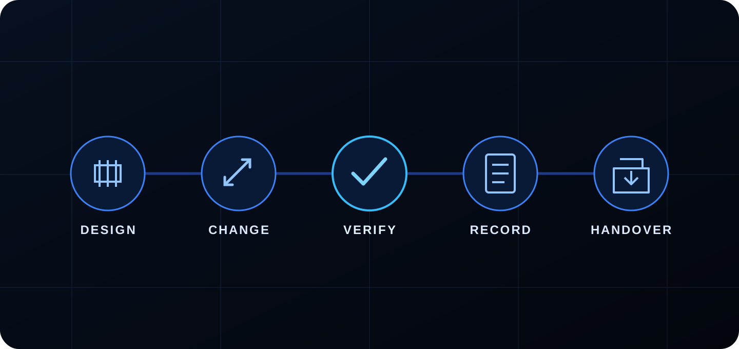
A good as-built record is not a folder of photos assembled at the end of a project. It is a continuous process: record changes, capture work before it is concealed, verify positions and versions, update drawings or models, and prepare a handover that someone else can navigate.
1. What “as-built” documenting really means
As-built documents describe what was built, incorporating changes to the design and revisions produced during execution. The scope may include drawings, BIM model, change records, sheets, tests, manuals and asset data. Must be defined in contract: the term As-Built is used unequally.
Photographs show visible conditions at one time. They help verify routes, meetings and work prior to closing, but they do not by themselves convert the design into an as-built plan. The National Park Service guidelines on as-constructed drawings They require incorporating revisions and changes to the documentary set.
The final record is born from a controlled chain; a photo gallery is just one of its sources.
2. Plan before you start closing
Defines the person responsible, nomenclature, formats, level of detail, tolerances, coordinate system, review process and delivery date. Clarifies which contractor updates each discipline and who validates the consolidated information.
List elements that will be hidden and critical points by area.
Relate each point to plan, model, specification and program activity.
Set capture milestones: before insulation, closure, filling, concreting or commissioning.
Defines when a modification requires survey, plan marking or approval.
Test from the beginning how the information will be searched at the end.
3. What to photograph before it disappears
System
Priority catches
Additional reference
False ceiling
Trays, ducts, pipes, supports, valves, registers and crossings
Axes, stay, elevation and MEP plane
Wall chases and linings
Routes, boxes, derivations, fixations and penetrations
Complete facing and distance to permanent references
Floors and exteriors
Buried networks, manholes, drainage, waterproofing and joints
Survey, depth and applicable test
Structure
Reinforcements, anchors, inserts, reinforcements and gaps before concreting
Inspection, lot and detail plan
Building envelope
Layers, seals, barriers, meetings and hidden fixings
Approved detail and quality control
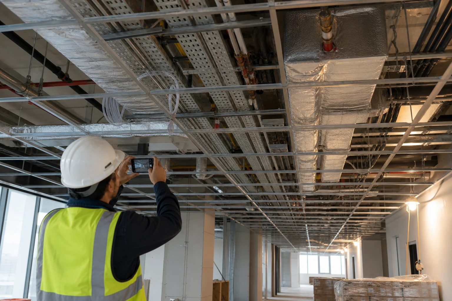
Editorial photography generated by AI. The moment of capture is critical: after closure, the route is no longer observable.
4. A sequence that allows the context to be reconstructed
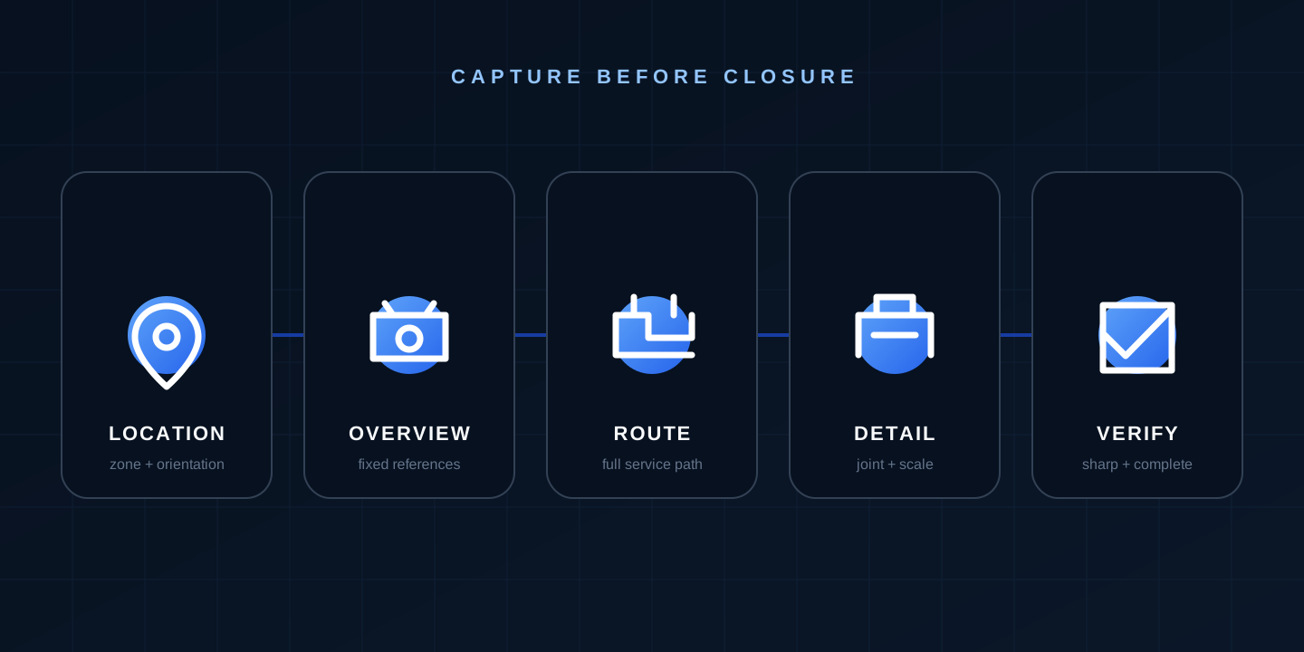
For each area, combine a general view that identifies the place, a tour view and the necessary details. Include permanent references - axes, openings, pillars or room limits - and do not cover the condition with a rule or label. Replay the view after major corrections.
Area, route, detail and subsequent state form a sequence that is more interpretable than isolated close-ups.
Caution: A visible tape measure can provide approximate scale, but does not convert the image into a metric survey.
5. Log each change against a version
The record must explain what changed, where, with respect to which document, why, who authorized it and what verification was done. Do not silently correct a plan without preserving traceability. Relates RFI, change order, marked plan, inspection and relevant photographs.
Avoid using the photo as the only definition of the change. Framing can hide connections or dimensions. Transfer the modification to the responsible plan or model and mark its status: proposed, approved, executed, verified or incorporated into the delivery.
6. Check location and dimension with correct method
The GPS of a telephone can help locate exteriors, but it is usually insufficient to distinguish interior routes or precise dimensions. An off-plan pin must be validated. For contractually relevant positions, use surveying, scanning, controlled measurement or the specified method, with its tolerances.
7. Structure the information so that it is recoverable
Associate each image with project, building, floor, area, discipline, element, date, author and documentary reference. Preserves the original file and prevents an export from removing important metadata. If a location or description is corrected, record who did it.
The British Guide to “golden thread” of information on higher risk buildings requires that the applicable information be digital, secure, accessible, usable and maintained. Although its legal scope is specific, these attributes are useful in designing any durable delivery.
8. Prepare a delivery that someone else can use
Before delivering, verify versions, broken references, coordinates, permissions, required open or native formats, index, conventions and correspondence between plan, model and annexes. Separates approved documents from work material and records limitations or unverified areas.
Reviewed as-built plans or models.
Linked change and approval log.
Results of tests, inspections and commissioning.
Relevant photographic selection, not an indiscriminate dump.
Reference manual, folder structure, access and conservation.
The NPS delivery requirements They are an example of how an organization specifies documentary formats and sets; In each project, the contract and applicable regulations prevail.
9. How Pic on Site can help
1. Gather team photos
Centralize images of work so that they do not depend on mobile phones and personal folders.
2. Place the captures
Photos with valid GPS can be displayed on a map or georeferenced plan; The location should be reviewed, especially indoors.
3. Recover the right moment
Filter by date and search for related visual content to find candidates before a review.
4. Submit the relevant selection
Share images that support an area, change or detail, along with documentary references.
Product limit: Pic on Site does not itself generate plans or As-Built models, does not measure precision coordinates, does not validate design compliance, and is not a substitute for professional inspections, surveys, or approval.
10. Checklist before closing and delivering
Deliverables, responsible parties, tolerances and formats are defined.
Each change is related to a version and authorization.
Hidden facilities have a general view, route and detail.
Zones can be identified without depending on the author's memory.
Critical positions were verified with the required method.
Plans or models incorporate the executed state.
Photos, inspections, tests and changes are linked.
Working versions and approved documents are separate.
Access, data protection and conservation are resolved.
A person unrelated to the capture has tested the recovery.
11. Frequently asked questions
Is it enough to photograph all the facilities?
No. You need to know what each photo shows, where it is, what change or plan it corresponds to, and how it was verified.
Does the GPS work inside the building?
It may be inaccurate or unavailable. Validates the position on the plane and uses spatial references or controlled measurement.
What happens if an area was not photographed before closure?
Search the lagoon. Don't invent a position based on clues. Consider alternative documentation or non-destructive inspection according to risk and authority.
Does visual search automatically identify the correct installation?
No. You can locate similar candidates; a person must check project, area, date, route and reference.